2. Layer Concept
With the Kontextmap CMS you can structure your map over several layers – or not. Design the map the way that best suits your concept.
If you decide to use several layers, you offer your readers the possibility to zoom in deeper and deeper into the topic. Then you can decide which elements should be visible on which layers.
For the clustering of the map in layers the structure in hierarchy levels has proven itself. On the live map, the reader then zooms from layer to layer, from the overview to the detailed overall network. But there are many more ways how the layers can be used sensibly. There is no limit to your creativity here.
Just note that some readers, depending on their browser settings and type of use, may very quickly move from the first to the last level by zooming. They might skip elements that are only on an intermediate level.
Also note: The number of layers influences the zoom factor. This means: The more layers, the higher the zoom factor of the visible elements.
Constant visibility
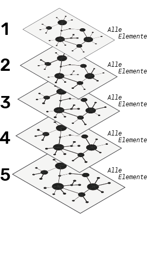
If all elements of a map are visible from the first to the last level, only the size of the element changes when zooming in. The more layers you set, the more you can zoom in.
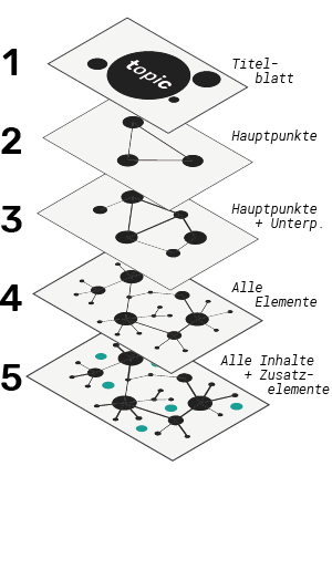
Step-by-step structuring
For this purpose, the diagram is built up step by step over all levels. For example, an outline from the overview or the main elements to the highest level of detail. The next lower level then appears in addition to the already visible points. In this example, a title page is set on the first level, which is no longer visible from the second level onwards.
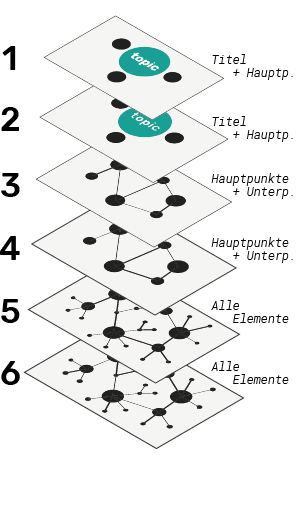
Multiple layers with the same content:
If you cluster your diagram over several layers, the graded structuring does not necessarily have to be done over the next layer. It is also possible to set the same content over several layers, e.g. to increase the zoom factor and create a longer diving experience.